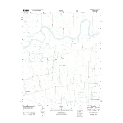
2013 Map of Telephone
USGS Topo · Published 2013About this map
The Red River snakes along the northern edge of this Fannin County landscape, serving as a prominent boundary line where numerous creeks and branches converge. This rural region is defined by the settlements of Elwood and Telephone, which are connected by a network of farm-to-market roads and county lanes. The area's local history is anchored by the Old Elwood Cem and Elwood Cem, providing important landmarks for genealogical research. To the west, the Reward Ranch Airport represents a modern transportation link amidst the agricultural fields. The terrain is deeply etched by watercourses such as Narvaugh Cr, Mud Br, and Robert Springs Br, which feed into the primary river system. Near the river, features like Island Bayou and Carman Lake Number 2 illustrate the dynamic nature of the floodplain, while the southern reaches are marked by the seasonal drainage of Dry Fork.
Find a feature on this map
54 named features on this map. Tap any name to fly to it.
Don’t see what you’re looking for? This feature index may not catch every label — zoom into the map to look around manually.
Map Details
Editions of this 2013 Telephone Map
This is the sole edition of this map. No revisions or reprints were ever made.
Other maps of this area

1903 · Paris
USGS Topo · 1:125,000

1947 · Honey Grove
USGS Topo · 1:62,500

1948 · Direct
USGS Topo · 1:62,500

1949 · Direct
USGS Topo · 1:62,500

1949 · Honey Grove
USGS Topo · 1:62,500

1953 · Texarkana
USGS Topo · 1:250,000

1954 · Sherman
USGS Topo · 1:250,000

1956 · Texarkana
USGS Topo · 1:250,000

1957 · Wade
USGS Topo · 1:62,500

1958 · Bonham
USGS Topo · 1:62,500