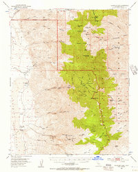
1952 Map of Telescope Peak
USGS Topo · Published 1957About this map
Ballarat sits on the eastern edge of the Panamint Valley, serving as a focal point for the mining and ranching activity recorded in this early 1950s survey. The landscape is defined by the steep transition from the valley floor to the high peaks of the Death Valley National Monument, including Telescope Peak and Rogers Peak. The map provides an intricate look at the extraction economy of the era, with numerous named claims such as the Wyoming Mine, Hudson River Mine, and Radcliffe Mine clustered in the canyons. Remote outposts and seasonal sites like Clair Camp and Hungry Bills Ranch appear alongside water sources essential for survival, including Hanaupah Spring and Brewery Spring. Evidence of earlier transport persists through the Stage Station (Ruins) and various jeep trails, while Indian Ranch Road skirts the base of the Panamint Range.
Find a feature on this map
64 named features on this map. Tap any name to fly to it.
Don’t see what you’re looking for? This feature index may not catch every label — zoom into the map to look around manually.
Map Details
Editions of this 1952 Telescope Peak Map
4 editions found

Other maps of this area

1908 · Furnace Creek
USGS Topo · 1:250,000

1908 · Ballarat
USGS Topo · 1:250,000

1910 · Furnace Creek
USGS Topo · 1:250,000

1913 · Ballarat
USGS Topo · 1:250,000

1915 · Searles Lake
USGS Topo · 1:250,000

1933 · Avawatz Mountains
USGS Topo · 1:250,000

1947 · Trona
USGS Topo · 1:250,000

1948 · Trona
USGS Topo · 1:250,000

1948 · Death Valley
USGS Topo · 1:250,000

1949 · Trona
USGS Topo · 1:62,500