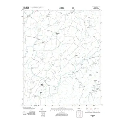
2011 Map of Telford
USGS Topo · Published 2011About this map
Washington College serves as the cultural anchor of this landscape, established as the first institution of higher learning west of the Alleghenies. The settlement pattern follows the rolling terrain between Little Limestone Creek and the Nolichucky River, where historic hamlets like Broylesville and Telford developed around early mills and rail spurs. In the southern reach of the quadrangle, the landscape shifts dramatically as it rises toward Embreeville Mountain. This area is marked by a heavy concentration of early 21st-century mining sites such as Big Moccasin Mine and the Starnes Mine, alongside evocative place names like Furnace Stack Hollow and Sally Hole. For genealogists, the map is remarkably dense with family-named landmarks and burial grounds, including the Sevier Cemetery, Waddell Cemetery, and Morning Star Cemetery.
Find a feature on this map
149 named features on this map. Tap any name to fly to it.
Don’t see what you’re looking for? This feature index may not catch every label — zoom into the map to look around manually.
Map Details
Editions of this 2011 Telford Map
This is the sole edition of this map. No revisions or reprints were ever made.
Other maps of this area

1891 · Roan Mountain
USGS Topo · 1:125,000

1892 · Greeneville
USGS Topo · 1:125,000

1894 · Roan Mountain
USGS Topo · 1:125,000

1896 · Greeneville
USGS Topo · 1:125,000

1904 · Roan Mountain
USGS Topo · 1:125,000

1904 · Greeneville
USGS Topo · 1:125,000

1935 · Chestoa
USGS Topo · 1:24,000

1935 · Leesburg
USGS Topo · 1:24,000

1935 · Erwin
USGS Topo · 1:24,000

1935 · Fall Branch
USGS Topo · 1:48,000