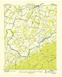
1936 Map of Telford
USGS Topo · Published 1936About this map
The Nolichucky River meanders through this portion of eastern Tennessee, dividing the valley lowlands from the rising slopes of the Cherokee National Forest. The landscape in the mid-1930s is defined by a dense network of country schools and churches, such as Mt Carmel Sch and McAllister Ch, alongside early industrial sites. The river's power was harnessed at multiple points, evidenced by Broylesville Mill, Graham Mill, and Adams Mill.
Find a feature on this map
78 named features on this map. Tap any name to fly to it.
Don’t see what you’re looking for? This feature index may not catch every label — zoom into the map to look around manually.
Map Details
Editions of this 1936 Telford Map
This is the sole edition of this map. No revisions or reprints were ever made.
Other maps of this area

1891 · Roan Mountain
USGS Topo · 1:125,000

1892 · Greeneville
USGS Topo · 1:125,000

1894 · Roan Mountain
USGS Topo · 1:125,000

1896 · Greeneville
USGS Topo · 1:125,000

1904 · Roan Mountain
USGS Topo · 1:125,000

1904 · Greeneville
USGS Topo · 1:125,000

1935 · Chestoa
USGS Topo · 1:24,000

1935 · Leesburg
USGS Topo · 1:24,000

1935 · Erwin
USGS Topo · 1:24,000

1935 · Fall Branch
USGS Topo · 1:48,000