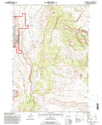
1992 Map of Teller Butte
USGS Topo · Published 1997About this map
Crooked River National Grassland dominates the western edge of this Jefferson County landscape, characterized by high-elevation plateaus and deep drainage cuts. The 1990s terrain is marked by a complex network of canyons, including Devils Canyon, Maids Canyon, and Red Shed Canyon, which provide a stark contrast to the prominent rise of Teller Butte and Eagle Point. Cultural history is anchored by the Hay Creek Cemetery in the south and the former location of Heisler Station, suggesting the early transport and settlement patterns of this arid region. Ranching and land management are evident through named improvements like Lyle Reservoir and the Hunter Grade, while numerous water sources such as Windy Brown Spring and Hatfield Spring reveal the critical importance of water rights in the high desert. Local landmarks like Indian Head Rock and a lone Landing Strip on the Teller Flat further define the utility of this expansive territory.
Find a feature on this map
43 named features on this map. Tap any name to fly to it.
Don’t see what you’re looking for? This feature index may not catch every label — zoom into the map to look around manually.
Map Details
Editions of this 1992 Teller Butte Map
This is the sole edition of this map. No revisions or reprints were ever made.
Other maps of this area

1928 · Madras
USGS Topo · 1:125,000

1931 · Madras
USGS Topo · 1:125,000

1955 · Bend
USGS Topo · 1:250,000

1957 · Bend
USGS Topo · 1:250,000

1958 · Bend
USGS Topo · 1:250,000

1962 · Gateway
USGS Topo · 1:24,000
1963 · Madras East
USGS Topo · 1:24,000
1963 · Buck Butte
USGS Topo · 1:24,000

1966 · Willowdale
USGS Topo · 1:62,500

1968 · Ashwood
USGS Topo · 1:24,000