
1951 Map of Teller
USGS Topo · Published 1952About this map
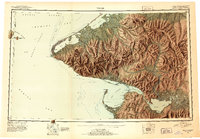
The Seward Peninsula meets the Bering Strait in this mid-century reconnaissance, marking the westernmost edge of the North American mainland at Cape Prince of Wales. This coastal landscape is defined by its strategic and industrial outposts, from the established settlement at Wales (Kingegan) to the industrial presence of Tin City and the Sullivan (Mining Camp). The map records several sites of former habitation, noting York (Aban'd) and Bering (Aban'd), while inland river networks like the Kugrupaga River and Nuluk River suggest the reach of resource extraction into the York Mountains. Offshore, the international boundary of the (U. S. - Russia Convention of 1867) runs between Little Diomede Island and Big Diomede Island, illustrating the unique proximity of the Ussr and the United States during the early Cold War era.
Find a feature on this map
127 named features on this map. Tap any name to fly to it.
Don’t see what you’re looking for? This feature index may not catch every label — zoom into the map to look around manually.
Map Details
Editions of this 1951 Teller Map
2 editions found
Other maps of this area

1950 · Bendeleben A-6
USGS Topo · 1:63,360

1950 · Bendeleben B-6
USGS Topo · 1:63,360

1950 · Bendeleben C-6
USGS Topo · 1:63,360

1950 · Nome D-2
USGS Topo · 1:63,360

1950 · Nome D-4
USGS Topo · 1:63,360

1950 · Bendeleben D-6
USGS Topo · 1:63,360

1950 · Nome
USGS Topo · 1:250,000

1950 · Teller
USGS Topo · 1:250,000

1950 · Bendeleben
USGS Topo · 1:250,000

1950 · Teller A-2
USGS Topo · 1:63,360