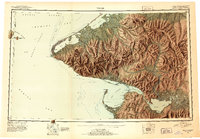
1951 Map of Teller
USGS Topo · Published 1952About this map
Wales and the northwestern tip of the Seward Peninsula stand at the meeting point of the Chukchi Sea and the Bering Sea in this mid-century reconnaissance. The mapping illustrates a strategic and remote landscape defined by the U.S. - Russia Convention of 1867 boundary line, which runs between Big Diomede Island and Little Diomede Island. Coastal life is centered around Grantley Harbor and the community of Teller, while the interior reveals the remnants of earlier mining and settlement activity at York and Bering.
Find a feature on this map
43 named features on this map. Tap any name to fly to it.
Don’t see what you’re looking for? This feature index may not catch every label — zoom into the map to look around manually.
Map Details
Editions of this 1951 Teller Map
2 editions found

Other maps of this area

1950 · Bendeleben A-6
USGS Topo · 1:63,360

1950 · Bendeleben B-6
USGS Topo · 1:63,360

1950 · Bendeleben C-6
USGS Topo · 1:63,360

1950 · Nome D-2
USGS Topo · 1:63,360

1950 · Nome D-4
USGS Topo · 1:63,360

1950 · Bendeleben D-6
USGS Topo · 1:63,360

1950 · Nome
USGS Topo · 1:250,000

1950 · Teller
USGS Topo · 1:250,000

1950 · Bendeleben
USGS Topo · 1:250,000

1950 · Teller A-2
USGS Topo · 1:63,360