
1950 Map of Teller A-2
USGS Topo · Published 1956About this map
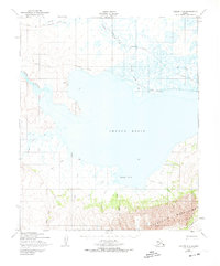
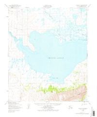
The Imuruk Basin dominates this sub-arctic landscape, serving as a critical hydrologic crossroads where the Agiapuk River and Duck Creek converge from the north. The basin drains westward through the narrow Tuksuk Channel, a vital waterway connecting the inland interior to the sea. To the south, the dramatic northern front of the Kigluaik Mountains rises sharply from the shore, cut by steep drainages including Glacier Canyon Creek and Snow Creek.
Find a feature on this map
16 named features on this map. Tap any name to fly to it.
Don’t see what you’re looking for? This feature index may not catch every label — zoom into the map to look around manually.
Map Details
Editions of this 1950 Teller A-2 Map
3 editions found
Other maps of this area

1950 · Nome D-2
USGS Topo · 1:63,360

1950 · Nome
USGS Topo · 1:250,000

1950 · Teller
USGS Topo · 1:250,000

1950 · Nome D-1
USGS Topo · 1:63,360

1950 · Teller A-1
USGS Topo · 1:63,360

1950 · Nome D-3
USGS Topo · 1:63,360

1950 · Teller B-2
USGS Topo · 1:63,360

1950 · Teller B-1
USGS Topo · 1:63,360

1950 · Teller A-3
USGS Topo · 1:63,360

1950 · Teller B-3
USGS Topo · 1:63,360