
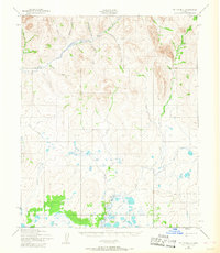
1950 Map of Teller B-1
USGS Topo · Published 1957About this map
Kougarok River flows through this remote Seward Peninsula landscape, which was mapped by the Army Map Service using aerial photography from 1950. The region is defined by a dense network of drainage systems, including Igloo Creek, Louisville Creek, and Kentucky Creek, which carve through the high-elevation terrain. A notable Tractor Trail provides the primary evidence of human passage through the area, winding through the valley near Hunter Creek and crossing the river. This trail network, often used for transporting heavy equipment to remote mining or survey sites, links the riverbanks with interior features like Winter Creek and Coco Creek. The absence of permanent settlements on the map underscores the isolation of this Arctic environment at the start of the 1950s, where movement was dictated by the river valleys and seasonal overland paths.
Find a feature on this map
17 named features on this map. Tap any name to fly to it.
Don’t see what you’re looking for? This feature index may not catch every label — zoom into the map to look around manually.
Map Details
Editions of this 1950 Teller B-1 Map
2 editions found
Other maps of this area

1950 · Bendeleben A-6
USGS Topo · 1:63,360

1950 · Bendeleben B-6
USGS Topo · 1:63,360

1950 · Bendeleben C-6
USGS Topo · 1:63,360

1950 · Teller
USGS Topo · 1:250,000

1950 · Bendeleben
USGS Topo · 1:250,000

1950 · Teller A-2
USGS Topo · 1:63,360

1950 · Teller A-1
USGS Topo · 1:63,360

1950 · Teller B-2
USGS Topo · 1:63,360

1950 · Teller C-2
USGS Topo · 1:63,360
1950 · Teller C-1
USGS Topo · 1:63,360