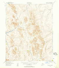
1950 Map of Teller C-1
USGS Topo · Published 1957About this map
Kougarok Mountain dominates this interior landscape of the Seward Peninsula, recorded during a 1950 aerial survey by the Army Map Service and Geological Survey. The region is defined by an extensive network of drainage and transport infrastructure built to support the Seward Peninsula's mining industry. Evidence of significant water management projects is visible through the winding paths of the Bismarck Ditch and Ottumwa Ditch, which redirected flow across complex terrain to support placer operations.
Find a feature on this map
26 named features on this map. Tap any name to fly to it.
Don’t see what you’re looking for? This feature index may not catch every label — zoom into the map to look around manually.
Map Details
Editions of this 1950 Teller C-1 Map
2 editions found
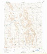
Other maps of this area

1950 · Bendeleben B-6
USGS Topo · 1:63,360

1950 · Bendeleben C-6
USGS Topo · 1:63,360

1950 · Bendeleben D-6
USGS Topo · 1:63,360

1950 · Teller
USGS Topo · 1:250,000

1950 · Bendeleben
USGS Topo · 1:250,000

1950 · Teller B-2
USGS Topo · 1:63,360

1950 · Teller B-1
USGS Topo · 1:63,360

1950 · Teller D-2
USGS Topo · 1:63,360

1950 · Teller C-2
USGS Topo · 1:63,360

1950 · Teller D-1
USGS Topo · 1:63,360