
1950 Map of Teller B-3
USGS Topo · Published 1957About this map
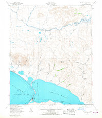
Teller stands at the strategic spit of land separating the tidal waters of Port Clarence from the interior reach of Grantley Harbor. This 1950s study, based on aerial photography from the Army Map Service, documents the remote coastal infrastructure of the Seward Peninsula before significant modern expansion. To the northwest lies Teller Mission, while the inland landscape is defined by the winding Agiapuk River and the heights of Mukacharni Mountain and Eva Mountain.
Find a feature on this map
43 named features on this map. Tap any name to fly to it.
Don’t see what you’re looking for? This feature index may not catch every label — zoom into the map to look around manually.
Map Details
Editions of this 1950 Teller B-3 Map
4 editions found
Other maps of this area

1950 · Teller
USGS Topo · 1:250,000

1950 · Teller A-2
USGS Topo · 1:63,360

1950 · Teller B-4
USGS Topo · 1:63,360

1950 · Teller B-2
USGS Topo · 1:63,360

1950 · Teller C-3
USGS Topo · 1:63,360

1950 · Teller A-3
USGS Topo · 1:63,360

1950 · Teller C-4
USGS Topo · 1:63,360

1950 · Teller A-4
USGS Topo · 1:63,360

1950 · Teller C-2
USGS Topo · 1:63,360

1951 · Teller
USGS Topo · 1:250,000