
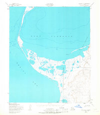
1950 Map of Teller A-4
USGS Topo · Published 1957About this map
Port Clarence and the northern reaches of the Bering Sea define this coastal landscape near the Seward Peninsula during the mid-century era. The geography is dominated by the narrow spit of land reaching toward Jones Point, where the Point Spencer Airfield (Abd) is noted as abandoned, reflecting the shifting military and aviation requirements of the post-war years. A significant Tidal Flat sits protected within the harbor, illustrating the complex shoreline and shallow soundings of the bay.
Find a feature on this map
13 named features on this map. Tap any name to fly to it.
Don’t see what you’re looking for? This feature index may not catch every label — zoom into the map to look around manually.
Map Details
Editions of this 1950 Teller A-4 Map
2 editions found
Other maps of this area

1950 · Nome D-4
USGS Topo · 1:63,360

1950 · Nome
USGS Topo · 1:250,000

1950 · Teller
USGS Topo · 1:250,000

1950 · Nome D-3
USGS Topo · 1:63,360

1950 · Teller B-4
USGS Topo · 1:63,360

1950 · Teller A-3
USGS Topo · 1:63,360

1950 · Teller B-3
USGS Topo · 1:63,360
1950 · Teller B-5
USGS Topo · 1:63,360

1951 · Nome
USGS Topo · 1:250,000

1951 · Teller
USGS Topo · 1:250,000