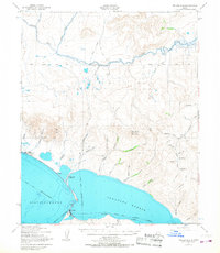
1950 Map of Teller B-3
USGS Topo · Published 1967About this map
Teller and the neighboring Brevig Mission anchor this coastal landscape along the northern reaches of Port Clarence and Grantley Harbor. This mid-century survey reveals a maritime and tundra-based economy where traditional seasonal locations like Fish Camp and the formerly active Reindeer Camp (Aban'd) define the shoreline. The land is navigated by a network of Winter Trails and Tractor Trails, highlighting the logistical challenges of the Seward Peninsula before modern infrastructure. Inland, the terrain rises toward significant heights like Mukacharni Mountain and Red Mtn, while the Agiapuk River meanders across the northern portion of the map, crossed by the Kateel River Base Line. Smaller coastal landmarks such as Fourmile Pt and Sixmile Pt provide reference points for those traveling by water or along the narrow gravel spits that characterize this subarctic environment.
Find a feature on this map
50 named features on this map. Tap any name to fly to it.
Don’t see what you’re looking for? This feature index may not catch every label — zoom into the map to look around manually.
Map Details
Editions of this 1950 Teller B-3 Map
4 editions found
Other maps of this area

1950 · Teller
USGS Topo · 1:250,000

1950 · Teller A-2
USGS Topo · 1:63,360

1950 · Teller B-4
USGS Topo · 1:63,360

1950 · Teller B-2
USGS Topo · 1:63,360

1950 · Teller C-3
USGS Topo · 1:63,360

1950 · Teller A-3
USGS Topo · 1:63,360

1950 · Teller C-4
USGS Topo · 1:63,360

1950 · Teller A-4
USGS Topo · 1:63,360

1950 · Teller C-2
USGS Topo · 1:63,360

1950 · Teller B-3
USGS Topo · 1:63,360