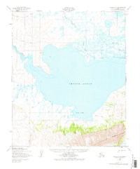
1950 Map of Teller A-2
USGS Topo · Published 1977About this map
The Imuruk Basin dominates this 1950 survey, serving as a massive brackish water body that links the interior river systems to the sea. To the north, the Agiapuk River and its tributaries like Duck Creek meander through a low-lying tundra landscape marked by many small ponds. A singular Winter Trail provides a overland route across this northern section, connecting isolated cabins that supported seasonal subsistence or trapping activities.
Find a feature on this map
19 named features on this map. Tap any name to fly to it.
Don’t see what you’re looking for? This feature index may not catch every label — zoom into the map to look around manually.
Map Details
Editions of this 1950 Teller A-2 Map
3 editions found
Other maps of this area

1950 · Nome D-2
USGS Topo · 1:63,360

1950 · Nome
USGS Topo · 1:250,000

1950 · Teller
USGS Topo · 1:250,000

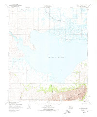
1950 · Teller A-2
USGS Topo · 1:63,360

1950 · Nome D-1
USGS Topo · 1:63,360

1950 · Teller A-1
USGS Topo · 1:63,360

1950 · Nome D-3
USGS Topo · 1:63,360

1950 · Teller B-2
USGS Topo · 1:63,360

1950 · Teller B-1
USGS Topo · 1:63,360

1950 · Teller A-3
USGS Topo · 1:63,360