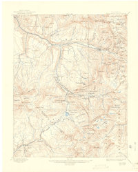
1904 Map of Telluride
USGS Topo · Published 1922About this map
The silver and gold mining economy of the San Miguel Mountains is captured in high detail at the turn of the century, centered on the bustling hub of Telluride and the nearby industrial site at Pandora. This survey illustrates a landscape defined by verticality and extraction, where gravity-fed systems like the Smuggler Union Mill and complex underground networks including the Bullion Tunnel and Sheridan Tunnel dominated the high basins. The Rio Grande Southern R.R. winds through the canyons, connecting remote outposts like Ophir and Sawpit to the main line at Vance Junction. High-altitude water management is evident at Trout Lake and Ice Lake, which provided the necessary power and processing resources for the dozens of operations like the Gold King Mill and Alta Mine perched along the steep ridges of Silver Mountain.
Find a feature on this map
159 named features on this map. Tap any name to fly to it.
Don’t see what you’re looking for? This feature index may not catch every label — zoom into the map to look around manually.
Map Details
Editions of this 1904 Telluride Map
2 editions found

Other maps of this area

1897 · Rico
USGS Topo · 1:62,500

1897 · Telluride
USGS Topo · 1:62,500

1897 · Silverton
USGS Topo · 1:62,500

1898 · Engineer Mountain
USGS Topo · 1:62,500

1898 · Rico
USGS Topo · 1:62,500

1899 · Rico
USGS Topo · 1:62,500

1900 · Engineer Mountain
USGS Topo · 1:62,500

1900 · Needle Mountains
USGS Topo · 1:62,500

1901 · Silverton
USGS Topo · 1:62,500

1902 · Needle Mountains
USGS Topo · 1:62,500