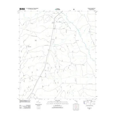
2012 Map of Telogia
USGS Topo · Published 2012About this map
Telogia and Liberty anchor this central Florida panhandle landscape during a period of modern forestry and rural expansion. The winding course of Telogia Cr and its many tributaries, such as Big Br and Yellow Cr, dictate the movement of local traffic across northern Liberty County. The map documents several small, family-associated burial grounds including Old Burnoff Cem, Evans Cem, and McNair Cem, which serve as vital markers for genealogical research in the region. To the west, the Apalachicola National Forest boundary encompasses the Brushy Islands and the Mercer Fire Tower, illustrating the area's transition from agricultural settlements to managed timberland. Local place names like Clio, Conners Ford, and Black Curve represent the specific geographic identity of this quiet interior corridor.
Find a feature on this map
53 named features on this map. Tap any name to fly to it.
Don’t see what you’re looking for? This feature index may not catch every label — zoom into the map to look around manually.
Map Details
Editions of this 2012 Telogia Map
This is the sole edition of this map. No revisions or reprints were ever made.
Other maps of this area

1943 · Lake Talquin
USGS Topo · 1:62,500

1944 · Queens Bay
USGS Topo · 1:24,000

1945 · Smith Creek
USGS Topo · 1:31,680

1945 · Hosford
USGS Topo · 1:31,680

1945 · Bristol
USGS Topo · 1:31,680

1945 · Woods
USGS Topo · 1:31,680

1945 · Telogia
USGS Topo · 1:24,000

1946 · Queens Bay
USGS Topo · 1:31,680

1946 · Telogia
USGS Topo · 1:31,680
1946 · Wilma
USGS Topo · 1:31,680