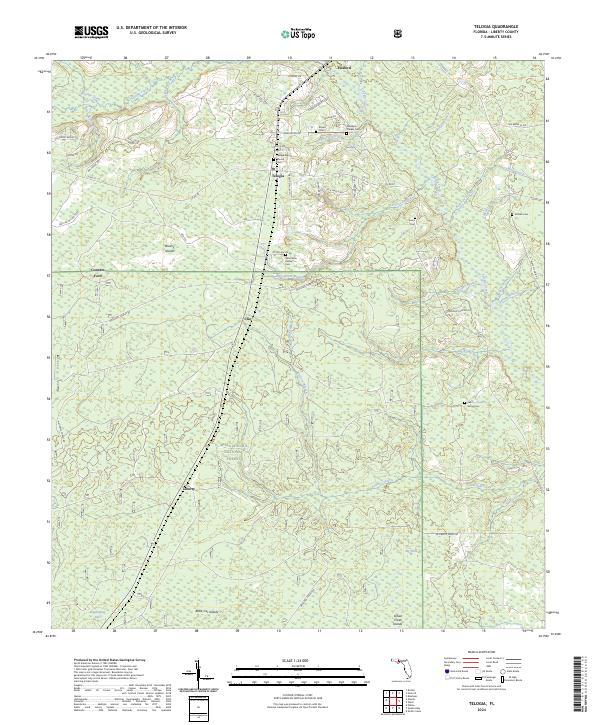
2024 Map of Telogia
USGS Topo · Published 2024About this map
The Apalachicola National Forest dominates this section of Liberty County, where scattered settlements like Telogia and Clio persist alongside timberlands and cypress strands. The area's genealogy is preserved in numerous family and community burial grounds, including the Summerlin Family Cem, McNair Cem, and Saint Marys Cem. The landscape is defined by a dense network of waterways such as Telogia Creek, Yellow Creek, and Big Cypress Branch, which likely influenced early travel routes like Conners Ford.
Find a feature on this map
68 named features on this map. Tap any name to fly to it.
Don’t see what you’re looking for? This feature index may not catch every label — zoom into the map to look around manually.
Map Details
Editions of this 2024 Telogia Map
This is the sole edition of this map. No revisions or reprints were ever made.
Other maps of this area

1943 · Lake Talquin
USGS Topo · 1:62,500

1944 · Queens Bay
USGS Topo · 1:24,000

1945 · Smith Creek
USGS Topo · 1:31,680

1945 · Hosford
USGS Topo · 1:31,680

1945 · Bristol
USGS Topo · 1:31,680

1945 · Woods
USGS Topo · 1:31,680

1945 · Telogia
USGS Topo · 1:24,000

1946 · Queens Bay
USGS Topo · 1:31,680

1946 · Telogia
USGS Topo · 1:31,680
1946 · Wilma
USGS Topo · 1:31,680