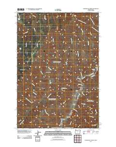
2011 Map of Temperance Creek
USGS Topo · Published 2011About this map
The Snake River carves a deep path through the canyonlands of Idaho County, defining the eastern border of this 2011 survey. The landscape is characterized by a series of high ridges and saddles, such as Wing Ridge and Hominy Saddle, which separate numerous seasonal and perennial drainages including Temperance Creek and Caribou Creek. These watercourses flow toward the river, where geological flats known as bars provided rare level ground for early activity.
Find a feature on this map
37 named features on this map. Tap any name to fly to it.
Don’t see what you’re looking for? This feature index may not catch every label — zoom into the map to look around manually.
Map Details
Editions of this 2011 Temperance Creek Map
This is the sole edition of this map. No revisions or reprints were ever made.
Other maps of this area

1922 · He Devil
USGS Topo · 1:48,000

1938 · Riggins
USGS Topo · 1:96,000

1945 · Riggins
USGS Topo · 1:125,000

1954 · Kernan Point
USGS Topo · 1:62,500

1955 · Grangeville
USGS Topo · 1:250,000

1957 · He Devil
USGS Topo · 1:62,500

1959 · Grangeville
USGS Topo · 1:250,000

1963 · Kirkwood Creek
USGS Topo · 1:24,000

1963 · Grave Point
USGS Topo · 1:24,000
1964 · Kessler Creek
USGS Topo · 1:24,000