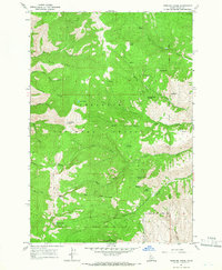
1964 Map of Kessler Creek
USGS Topo · Published 1966About this map
The Nez Perce National Forest dominates this mid-1960s survey of Idaho County, showcasing a landscape defined by dramatic elevation changes and essential water sources. High peaks such as Bald Mountain and Blue Mountain anchor the terrain, while specialized landmarks like the Papoose Cavern and a solitary Prospect indicate the region's geological and mining interests. The map documents a network of primitive transportation, featuring a prominent Jeep Trail that navigates the ridges between deep drainages. Strategic mountain passes, including Fire Camp Saddle and Grave Creek Saddle, mark the historical routes through the forest. Water is a constant presence, from high-altitude features like Crater Lake and Papoose Lake to numerous named seeps such as Tony Seufreid Spring and Indian Springs, which would have been vital checkpoints for forest rangers and early backcountry travelers.
Find a feature on this map
38 named features on this map. Tap any name to fly to it.
Don’t see what you’re looking for? This feature index may not catch every label — zoom into the map to look around manually.
Map Details
Editions of this 1964 Kessler Creek Map
2 editions found
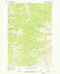
Other maps of this area

1922 · He Devil
USGS Topo · 1:48,000

1938 · Riggins
USGS Topo · 1:96,000

1945 · Riggins
USGS Topo · 1:125,000

1954 · Kernan Point
USGS Topo · 1:62,500

1955 · Grangeville
USGS Topo · 1:250,000

1957 · He Devil
USGS Topo · 1:62,500

1959 · Grangeville
USGS Topo · 1:250,000

1963 · Lucile
USGS Topo · 1:24,000

1963 · Kirkwood Creek
USGS Topo · 1:24,000

1964 · Riggins
USGS Topo · 1:24,000