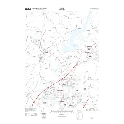
2013 Map of Temple
USGS Topo · Published 2013About this map
The Schuylkill River and Maiden Creek converge at the center of this Berks County landscape, framing a region defined by its water resources and transportation corridors. To the northeast, the massive Ontelaunee Lake dominates the topography, while the southern portion of the map transitions into the suburban industrial and residential clusters of Muhlenberg and Laureldale. This 2013 survey illustrates the modern footprint of a valley with deep agricultural and industrial roots, where the Reading Blue Mountain & Northern RR follows the river's path through established communities like Leesport and Mohrsville. Local recreation and infrastructure are well-documented, from the Schellhammer Speedway near Dauberville to the expansive Reading Regional Airport/Carl A Spaatz Field in the southwest, showing how twentieth-century development integrated with the winding waterway.
Find a feature on this map
223 named features on this map. Tap any name to fly to it.
Don’t see what you’re looking for? This feature index may not catch every label — zoom into the map to look around manually.
Map Details
Editions of this 2013 Temple Map
This is the sole edition of this map. No revisions or reprints were ever made.
Other maps of this area

1889 · Pottsville
USGS Topo · 1:62,500

1891 · Pottsville
USGS Topo · 1:62,500

1894 · Reading
USGS Topo · 1:62,500

1902 · Wernersville
USGS Topo · 1:62,500

1909 · Hamburg
USGS Topo · 1:62,500

1911 · Hamburg
USGS Topo · 1:62,500

1913 · Reading
USGS Topo · 1:62,500

1915 · Reading
USGS Topo · 1:62,500

1943 · Wernersville
USGS Topo · 1:62,500

1944 · Reading
USGS Topo · 1:62,500
Featured Places
- Muhlenberg Park, Muhlenberg Township
- Laureldale, PA
- Leesport, PA
- Shoemakersville, PA
- Ontelaunee Township, PA