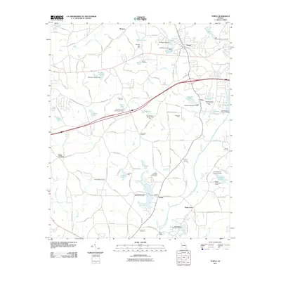
2011 Map of Temple
USGS Topo · Published 2011About this map
The town of Temple sits at a historic crossroads in northern Georgia, where the rail-and-road corridor meets a landscape defined by the upper reaches of the Little Tallapoosa River. This 2011 survey illustrates a region shaped by modern water management and aviation, anchored by Wilson International Airport and numerous reservoirs like Easterwood Lake and Little Tallapoosa Lake. Rural heritage remains deeply visible through a network of family and community burial grounds, including the McMullen Cemetery, Spence Cemetery, and Abilene Cemetery.
Find a feature on this map
126 named features on this map. Tap any name to fly to it.
Don’t see what you’re looking for? This feature index may not catch every label — zoom into the map to look around manually.
Map Details
Editions of this 2011 Temple Map
This is the sole edition of this map. No revisions or reprints were ever made.
Other maps of this area

1889 · Tallapoosa
USGS Topo · 1:125,000

1891 · Marietta
USGS Topo · 1:125,000

1892 · Tallapoosa
USGS Topo · 1:125,000

1895 · Marietta
USGS Topo · 1:125,000

1897 · Marietta
USGS Topo · 1:125,000

1897 · Tallapoosa
USGS Topo · 1:125,000

1901 · Marietta
USGS Topo · 1:125,000

1953 · Atlanta
USGS Topo · 1:250,000

1957 · Atlanta
USGS Topo · 1:250,000

1958 · Atlanta
USGS Topo · 1:250,000