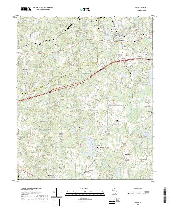
2024 Map of Temple
USGS Topo · Published 2024About this map
Temple and the neighboring settlements of Abilene and Shady Grove occupy this West Georgia landscape, situated along the Haralson and Carroll county line. The Norfolk Southern railroad runs east-west through the northern half of the region, connecting the small-town centers and supporting the area's historical movement of goods. Numerous family and community cemeteries are scattered throughout the countryside, including the McMullen Williamson Cem, Center Point Cem, and Spence Cem, which provide significant points of interest for local genealogy and history research.
Find a feature on this map
179 named features on this map. Tap any name to fly to it.
Don’t see what you’re looking for? This feature index may not catch every label — zoom into the map to look around manually.
Map Details
Editions of this 2024 Temple Map
This is the sole edition of this map. No revisions or reprints were ever made.
Other maps of this area

1889 · Tallapoosa
USGS Topo · 1:125,000

1891 · Marietta
USGS Topo · 1:125,000

1892 · Tallapoosa
USGS Topo · 1:125,000

1895 · Marietta
USGS Topo · 1:125,000

1897 · Marietta
USGS Topo · 1:125,000

1897 · Tallapoosa
USGS Topo · 1:125,000

1901 · Marietta
USGS Topo · 1:125,000

1953 · Atlanta
USGS Topo · 1:250,000

1957 · Atlanta
USGS Topo · 1:250,000

1958 · Atlanta
USGS Topo · 1:250,000