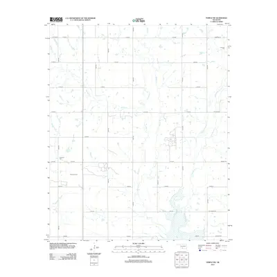
2012 Map of Temple NW
USGS Topo · Published 2012About this map
Walters Oil Field anchors the western portion of this rural Oklahoma landscape, indicating the sustained role of energy extraction in the region. The terrain is defined by the drainage networks of Beaver Cr, Gooden Cr, and Little Beaver Cr, which snake through the sectioned agricultural land. Genealogical interest is centered on the Comanche Cem in the northeast and Shakelford Cem to the west, providing focal points for local family history research. The road system follows a strict cardinal grid, yet features unique local identifiers like Refinery Rd, Cattlemans Rd, and the curiously named Dr Pepper Rd. This 2012 survey illustrates the intersection of traditional cattle ranching and modern oil production in Stephens County.
Find a feature on this map
29 named features on this map. Tap any name to fly to it.
Don’t see what you’re looking for? This feature index may not catch every label — zoom into the map to look around manually.
Map Details
Editions of this 2012 Temple NW Map
This is the sole edition of this map. No revisions or reprints were ever made.
Other maps of this area

1946 · Lawton
USGS Topo · 1:62,500

1949 · Nellie
USGS Topo · 1:62,500

1955 · Lawton
USGS Topo · 1:250,000

1956 · Ninemile Creek
USGS Topo · 1:24,000

1956 · Letitia
USGS Topo · 1:24,000

1956 · Nellie
USGS Topo · 1:24,000

1956 · Lawton
USGS Topo · 1:62,500

1956 · Nellie
USGS Topo · 1:62,500

1962 · Walters
USGS Topo · 1:62,500

1962 · Temple
USGS Topo · 1:62,500