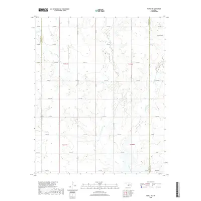
2018 Map of Temple NW
USGS Topo · Published 2018About this map
Beaver Cr and its tributaries, Gooden Cr and Little Beaver Cr, carve a winding drainage pattern across this section of southern Oklahoma where Cotton, Stephens, and Comanche counties meet. The landscape is defined by the Public Land Survey System grid, with section lines marked by a network of county roads including Co RD e1740 and Co RD e1820. While the area is primarily rural and agricultural, evidence of local history and industry appears in the form of the Comanche Cem in the northeast and Shakelford Cem near the western boundary. Modern cultural markers and older infrastructure intersect at roads like Refinery Rd, Bois D Arc, and the uniquely named Dr Pepper Rd, reflecting the evolution of this prairie landscape from early tribal lands into a developed rural corridor.
Find a feature on this map
26 named features on this map. Tap any name to fly to it.
Don’t see what you’re looking for? This feature index may not catch every label — zoom into the map to look around manually.
Map Details
Editions of this 2018 Temple NW Map
This is the sole edition of this map. No revisions or reprints were ever made.
Other maps of this area

1946 · Lawton
USGS Topo · 1:62,500

1949 · Nellie
USGS Topo · 1:62,500

1955 · Lawton
USGS Topo · 1:250,000

1956 · Ninemile Creek
USGS Topo · 1:24,000

1956 · Letitia
USGS Topo · 1:24,000

1956 · Nellie
USGS Topo · 1:24,000

1956 · Lawton
USGS Topo · 1:62,500

1956 · Nellie
USGS Topo · 1:62,500

1962 · Walters
USGS Topo · 1:62,500

1962 · Temple
USGS Topo · 1:62,500