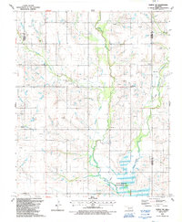
1987 Map of Temple NW
USGS Topo · Published 1988About this map
Beaver Creek and Gooden Creek wind through this corner of Cotton County, defining a landscape dominated by the local energy industry in the late 1980s. The map reveals an intensive network of an Oil Field and an Oil and Gas Field, marked by numerous individual Oil Wells and a Pipeline system. While the terrain is shaped by industrial extraction and agricultural land use, including several Gravel Pits, the southern portion of the quadrangle preserves a large State Wildlife Management Area where Little Beaver Creek meets the main channel.
Find a feature on this map
19 named features on this map. Tap any name to fly to it.
Don’t see what you’re looking for? This feature index may not catch every label — zoom into the map to look around manually.
Map Details
Editions of this 1987 Temple NW Map
This is the sole edition of this map. No revisions or reprints were ever made.
Other maps of this area

1946 · Lawton
USGS Topo · 1:62,500

1949 · Nellie
USGS Topo · 1:62,500

1955 · Lawton
USGS Topo · 1:250,000

1956 · Ninemile Creek
USGS Topo · 1:24,000

1956 · Letitia
USGS Topo · 1:24,000

1956 · Nellie
USGS Topo · 1:24,000

1956 · Lawton
USGS Topo · 1:62,500

1956 · Nellie
USGS Topo · 1:62,500

1962 · Walters
USGS Topo · 1:62,500

1962 · Temple
USGS Topo · 1:62,500