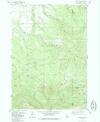
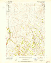
1979 Map of Temple Peak
USGS Topo · Published 1985About this map
Targhee National Forest dominates this landscape along the border of Madison and Teton Counties, where the terrain transitions from high ridges to deep canyons. The map documents a network of seasonal resource extraction and high-country travel, noted by the presence of a Mine in Coalmine Canyon and several jeep trails and pack trails like the Burns Trail. High-elevation water sources are central to the geography, including Moody Swamp, Spring Castle Lake, and the extensive Thousand Springs Valley. Small-scale evidence of land use appears in the northwest near the Browning area, where a Storage Bin, Borrow Pit, and Corral indicate localized activity. Named landmarks like Temple Peak, Prospect Peak, and Argument Ridge provide clear orientation points for researchers tracing the historical grazing and mining routes through these Idaho mountains.
Find a feature on this map
55 named features on this map. Tap any name to fly to it.
Don’t see what you’re looking for? This feature index may not catch every label — zoom into the map to look around manually.
Map Details
Editions of this 1979 Temple Peak Map
This is the sole edition of this map. No revisions or reprints were ever made.
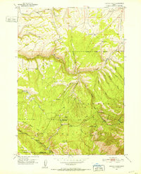
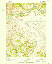
Other maps of this area
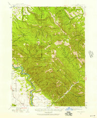
1943 · Garns Mtn
USGS Topo · 1:62,500

1946 · Garns Mtn
USGS Topo · 1:62,500
1951 · Hawley Gulch
USGS Topo · 1:24,000
1951 · Heise SE
USGS Topo · 1:24,000
1951 · White Owl Butte
USGS Topo · 1:24,000

1955 · Driggs
USGS Topo · 1:250,000

1958 · Driggs
USGS Topo · 1:250,000

1962 · Driggs
USGS Topo · 1:250,000
1965 · Packsaddle Lake
USGS Topo · 1:24,000
1965 · Wright Creek
USGS Topo · 1:24,000