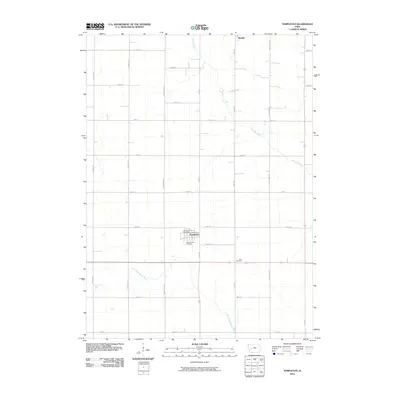
2010 Map of Templeton
USGS Topo · Published 2010About this map
The town of Templeton serves as the central hub of this Carroll County landscape, defined by a grid of agricultural section roads and the headwaters of regional waterways. The Templeton Post Office and Sacred Heart Cemetery mark the primary settlement, while the smaller community of Roselle sits at the northern boundary. The terrain is drained by the southward-flowing Brushy Creek and the East Nishnabotna River, which cuts across the southwestern corner of the quadrangle. For those researching local history, the map provides precise locations for the Elba Cemetery east of the main town and traces the path of many named thoroughfares, including Falcon Ave and Lynx Ave, which frame the rural sections. This survey captures the enduring layout of Iowa's farmland at the start of the 21st century.
Find a feature on this map
25 named features on this map. Tap any name to fly to it.
Don’t see what you’re looking for? This feature index may not catch every label — zoom into the map to look around manually.
Map Details
Editions of this 2010 Templeton Map
This is the sole edition of this map. No revisions or reprints were ever made.
Other maps of this area

1954 · Omaha
USGS Topo · 1:250,000

1954 · Fort Dodge
USGS Topo · 1:250,000

1957 · Omaha
USGS Topo · 1:250,000

1957 · Fort Dodge
USGS Topo · 1:250,000

1958 · Omaha
USGS Topo · 1:250,000

1958 · Fort Dodge
USGS Topo · 1:250,000

1971 · Viola Center
USGS Topo · 1:24,000

1971 · Dedham
USGS Topo · 1:24,000

1971 · Templeton
USGS Topo · 1:24,000

1971 · Gray
USGS Topo · 1:24,000