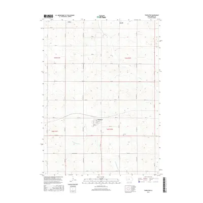
2015 Map of Templeton
USGS Topo · Published 2015About this map
Templeton anchors the southern portion of this Carroll County landscape, situated at the junction of Ivy Ave and Co Rd N14. The town's grid includes W 3rd St and W 4th St, with the Sacred Heart Cem located just south of the residential core. The surrounding countryside is defined by a dense network of sectional roads and the headwaters of the E Nishnabotna River, which meanders through the southwestern quadrant. To the north, the small settlements of Halbur and Roselle mark the limits of the survey area, connected by a series of gravel and paved routes like Co Rd E53. This agricultural region is punctuated by landmarks such as the Elba Cem and various rural creek crossings like Brushy Cr, illustrating the persistent agrarian land use patterns of western Iowa in the twenty-first century.
Find a feature on this map
40 named features on this map. Tap any name to fly to it.
Don’t see what you’re looking for? This feature index may not catch every label — zoom into the map to look around manually.
Map Details
Editions of this 2015 Templeton Map
This is the sole edition of this map. No revisions or reprints were ever made.
Other maps of this area

1954 · Omaha
USGS Topo · 1:250,000

1954 · Fort Dodge
USGS Topo · 1:250,000

1957 · Omaha
USGS Topo · 1:250,000

1957 · Fort Dodge
USGS Topo · 1:250,000

1958 · Omaha
USGS Topo · 1:250,000

1958 · Fort Dodge
USGS Topo · 1:250,000

1971 · Viola Center
USGS Topo · 1:24,000

1971 · Dedham
USGS Topo · 1:24,000

1971 · Templeton
USGS Topo · 1:24,000

1971 · Gray
USGS Topo · 1:24,000