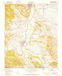
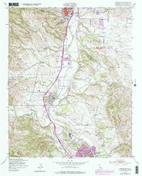
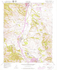
1948 Map of Templeton
USGS Topo · Published 1952About this map
The Salinas River valley in the late 1940s is characterized by a patchwork of early industrial and agricultural operations along the Southern Pacific railroad line. This corridor connects the southern edge of Paso Robles through the community of Templeton to the northern reaches of Atascadero. Rural education and community life are captured in the presence of the Trinity Ch and Eureka Sch, while the Bethel Sch (Abandoned) south of Peachy Canyon marks a shift in local demographics. The landscape is dotted with numerous windmills, essential for the livestock and Poultry Farms operating near Asuncion. Geological interest is found in the Quarries and natural features like Sulphur Spr and Neals Spr, which sit amidst the hills of the Santa Ysabel and Paso de Robles land grants.
Find a feature on this map
29 named features on this map. Tap any name to fly to it.
Don’t see what you’re looking for? This feature index may not catch every label — zoom into the map to look around manually.
Map Details
Editions of this 1948 Templeton Map
6 editions found
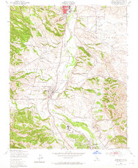
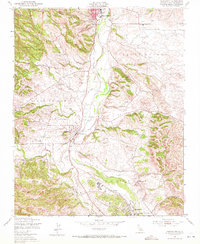
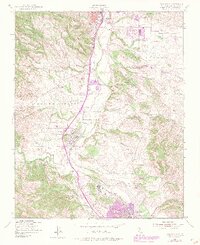
Other maps of this area

1897 · San Luis Obispo
USGS Topo · 1:62,500

1897 · Cayucos
USGS Topo · 1:62,500

1900 · San Luis
USGS Topo · 1:125,000

1919 · Paso Robles
USGS Topo · 1:62,500

1919 · Adelaida
USGS Topo · 1:62,500

1932 · Adelaida
USGS Topo · 1:62,500

1937 · Cayucos
USGS Topo · 1:62,500

1942 · Adelaida
USGS Topo · 1:62,500

1942 · San Luis Obispo
USGS Topo · 1:62,500

1943 · Paso Robles
USGS Topo · 1:62,500