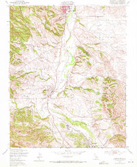
1948 Map of Templeton
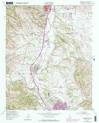
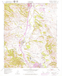
USGS Topo · Published 1972About this map
Templeton and Asuncion sit along the Southern Pacific rail line as it follows the broad course of the Salinas River through central San Luis Obispo County. This late 1940s landscape is defined by the remnants of Mexican land grants, including the Paso De Robles Grant Boundary and the Santa Ysabel Grant Boundary, which still shaped property divisions and land use decades later. To the north, the growing community of Paso Robles transitions into the hills of Peachy Canyon, while the southern edge of the survey reaches into Atascadero.
Find a feature on this map
23 named features on this map. Tap any name to fly to it.
Don’t see what you’re looking for? This feature index may not catch every label — zoom into the map to look around manually.
Map Details
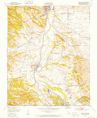
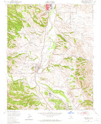
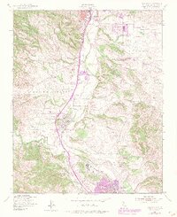
Editions of this 1948 Templeton Map
6 editions found
Other maps of this area

1897 · San Luis Obispo
USGS Topo · 1:62,500

1897 · Cayucos
USGS Topo · 1:62,500

1900 · San Luis
USGS Topo · 1:125,000

1919 · Paso Robles
USGS Topo · 1:62,500

1919 · Adelaida
USGS Topo · 1:62,500

1932 · Adelaida
USGS Topo · 1:62,500

1937 · Cayucos
USGS Topo · 1:62,500

1942 · Adelaida
USGS Topo · 1:62,500

1942 · San Luis Obispo
USGS Topo · 1:62,500

1943 · Paso Robles
USGS Topo · 1:62,500