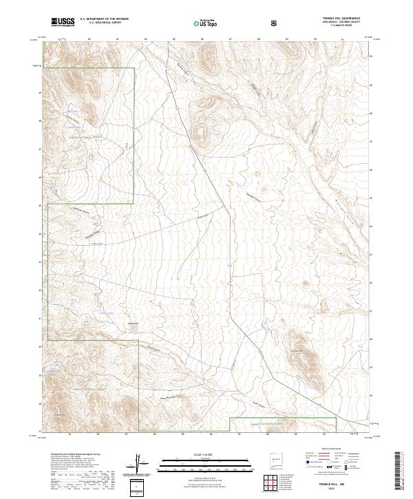
2023 Map of Tenmile Hill
USGS Topo · Published 2023About this map
Cibola National Forest defines the topography of this Socorro County landscape, where high-desert drainage systems and volcanic landforms intersect. The terrain is marked by significant elevations like Horse Mtn and Tenmile Hill, which serve as anchors for a series of complex canyons including Big Rosa Canyon and Rosedale Canyon. Water management is central to the land's utility, evidenced by a network of engineered catchment points such as Horse Mountain Tank, Wilson Tank, and Bald Tank. These features suggest a landscape managed for livestock or wildlife within the federal forest boundaries. The transportation network is sparse, relying on State Hwy 107 and forest access routes like Forest 330 Rd to navigate the rugged transition between the gulches of Milligan Gulch and the high ridges of Wilson Hill.
Find a feature on this map
25 named features on this map. Tap any name to fly to it.
Don’t see what you’re looking for? This feature index may not catch every label — zoom into the map to look around manually.
Map Details
Editions of this 2023 Tenmile Hill Map
This is the sole edition of this map. No revisions or reprints were ever made.
Other maps of this area

1954 · Tularosa
USGS Topo · 1:250,000

1958 · Tularosa
USGS Topo · 1:250,000

1961 · Hickman Ranch
USGS Topo · 1:24,000

1964 · San Juan Peak
USGS Topo · 1:24,000

1964 · Blue Mountain
USGS Topo · 1:24,000
1964 · Grassy Lookout
USGS Topo · 1:24,000
1965 · Tenmile Hill
USGS Topo · 1:24,000
1965 · Squaw Peak
USGS Topo · 1:24,000
1965 · Puertecito Gap
USGS Topo · 1:24,000
1965 · South Baldy
USGS Topo · 1:24,000