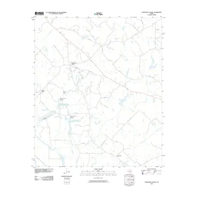
2010 Map of Tennessee Colony
USGS Topo · Published 2010About this map
Tennessee Colony and the surrounding Anderson County countryside appear as a network of rural homesteads and agricultural infrastructure in this 2010 survey. The landscape is defined by its water management and drainage systems, featuring the Soil Conservation Service Site 1 Reservoir and its companion, Site 2 Reservoir. These engineered water bodies, supported by structures like the Soil Conservation Service Site 1 Dam, illustrate the 20th-century push for flood control and soil stabilization in East Texas.
Find a feature on this map
37 named features on this map. Tap any name to fly to it.
Don’t see what you’re looking for? This feature index may not catch every label — zoom into the map to look around manually.
Map Details
Editions of this 2010 Tennessee Colony Map
This is the sole edition of this map. No revisions or reprints were ever made.
Other maps of this area

1949 · Palestine
USGS Topo · 1:62,500

1949 · Tennessee Colony
USGS Topo · 1:62,500

1950 · Palestine
USGS Topo · 1:62,500

1950 · Tennessee Colony
USGS Topo · 1:62,500

1951 · Elkhart
USGS Topo · 1:62,500

1953 · Palestine
USGS Topo · 1:250,000

1957 · Palestine
USGS Topo · 1:250,000

1964 · Long Lake
USGS Topo · 1:24,000
1964 · Butler
USGS Topo · 1:24,000

1981 · Palestine
USGS Topo · 1:100,000