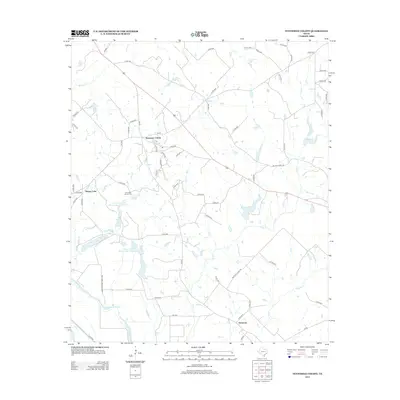
2013 Map of Tennessee Colony
USGS Topo · Published 2013About this map
Tennessee Colony serves as the central hub of this Anderson County landscape, where rural routes branch out into a network of small creeks and wetlands. The terrain is defined by the drainage systems of Beaver Cr and Spring Cr, which feed into larger water bodies and reservoirs established for local land management. Evidence of long-standing community life is visible at the Jimmison Quarter Cem, a site of significant genealogical value for local families. In the south, the settlement of Harmony sits near the winding paths of Keechie Cr, while the western edge of the map is bordered by the Trinity River. This document records a period of modern water conservation, featuring the Soil Conservation Service Site 1 Reservoir and its counterpart, Site 2 Reservoir, which have reshaped the traditional hydrology of the Texas plains.
Find a feature on this map
67 named features on this map. Tap any name to fly to it.
Don’t see what you’re looking for? This feature index may not catch every label — zoom into the map to look around manually.
Map Details
Editions of this 2013 Tennessee Colony Map
This is the sole edition of this map. No revisions or reprints were ever made.
Other maps of this area

1949 · Palestine
USGS Topo · 1:62,500

1949 · Tennessee Colony
USGS Topo · 1:62,500

1950 · Palestine
USGS Topo · 1:62,500

1950 · Tennessee Colony
USGS Topo · 1:62,500

1951 · Elkhart
USGS Topo · 1:62,500

1953 · Palestine
USGS Topo · 1:250,000

1957 · Palestine
USGS Topo · 1:250,000

1964 · Long Lake
USGS Topo · 1:24,000
1964 · Butler
USGS Topo · 1:24,000

1981 · Palestine
USGS Topo · 1:100,000