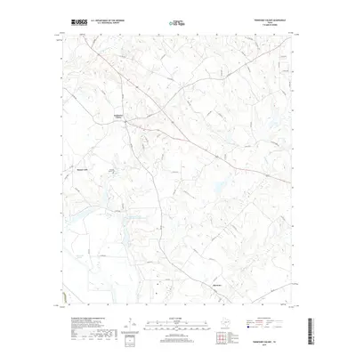
2019 Map of Tennessee Colony
USGS Topo · Published 2019About this map
Tennessee Colony sits at the heart of this Anderson County landscape, where the topography is defined by the complex drainage systems of several key waterways. To the north and east, Beaver Creek and Lake Creek carve through the terrain, while the southern reaches are marked by the presence of Harmony near the banks of Keechie Creek. The area reflects a history of local land management, evidenced by the Soil Conservation Service Site 2 Reservoir, which sits in the western portion of the quadrangle. Genealogists and local historians will find value in the location of the Jimmison Quarter Cem, situated near Spring Creek. The transport network includes the historically significant Wildcat Ferry Rd, pointing toward former river crossings, while the low-lying areas near Massey Lake and Cedar Lake Slough illustrate the natural wetland characteristics of this East Texas region.
Find a feature on this map
55 named features on this map. Tap any name to fly to it.
Don’t see what you’re looking for? This feature index may not catch every label — zoom into the map to look around manually.
Map Details
Editions of this 2019 Tennessee Colony Map
This is the sole edition of this map. No revisions or reprints were ever made.
Other maps of this area

1949 · Palestine
USGS Topo · 1:62,500

1949 · Tennessee Colony
USGS Topo · 1:62,500

1950 · Palestine
USGS Topo · 1:62,500

1950 · Tennessee Colony
USGS Topo · 1:62,500

1951 · Elkhart
USGS Topo · 1:62,500

1953 · Palestine
USGS Topo · 1:250,000

1957 · Palestine
USGS Topo · 1:250,000

1964 · Long Lake
USGS Topo · 1:24,000
1964 · Butler
USGS Topo · 1:24,000

1981 · Palestine
USGS Topo · 1:100,000