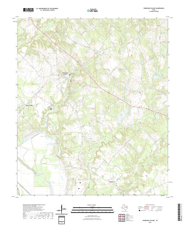
2022 Map of Tennessee Colony
USGS Topo · Published 2022About this map
Tennessee Colony and the rural community of Harmony anchor this landscape in Anderson County, where the transition from upland ridges to the bottomlands of the Trinity River defines the geography. The map reveals a high concentration of water management and drainage features, including the Soil Conservation Service Site 2 Reservoir and several creek systems like Beaver Creek and Spring Creek. Local history is preserved through named landmarks such as the Tennessee Colony Cem and Jemison Quarters Cem, providing essential touchstones for genealogical research in this part of East Texas.
Find a feature on this map
60 named features on this map. Tap any name to fly to it.
Don’t see what you’re looking for? This feature index may not catch every label — zoom into the map to look around manually.
Map Details
Editions of this 2022 Tennessee Colony Map
This is the sole edition of this map. No revisions or reprints were ever made.
Other maps of this area

1949 · Palestine
USGS Topo · 1:62,500

1949 · Tennessee Colony
USGS Topo · 1:62,500

1950 · Palestine
USGS Topo · 1:62,500

1950 · Tennessee Colony
USGS Topo · 1:62,500

1951 · Elkhart
USGS Topo · 1:62,500

1953 · Palestine
USGS Topo · 1:250,000

1957 · Palestine
USGS Topo · 1:250,000

1964 · Long Lake
USGS Topo · 1:24,000
1964 · Butler
USGS Topo · 1:24,000

1981 · Palestine
USGS Topo · 1:100,000