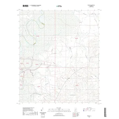
2020 Map of Tensaw
USGS Topo · Published 2020About this map
Tensaw lies at the heart of this landscape where the Alabama River and its intricate network of backwaters define the boundary between Baldwin and Clarke counties. The terrain is characterized by a complex system of bottomland hydrology, including Silver Lake, Southfield Lake, and several "guts" and creeks that drain into the main river channel. The road network reveals the area's rural orientation, with routes like Fort Mims Rd, Atkinson Mill Rd, and St Luke Church Rd connecting localized homesteads and historical sites.
Find a feature on this map
43 named features on this map. Tap any name to fly to it.
Don’t see what you’re looking for? This feature index may not catch every label — zoom into the map to look around manually.
Map Details
Editions of this 2020 Tensaw Map
This is the sole edition of this map. No revisions or reprints were ever made.
Other maps of this area

1942 · Perdido
USGS Topo · 1:62,500

1943 · Choctaw Bluff
USGS Topo · 1:62,500

1943 · Tensaw
USGS Topo · 1:62,500

1944 · Tensaw
USGS Topo · 1:62,500

1944 · Perdido
USGS Topo · 1:62,500

1946 · Choctaw Bluff
USGS Topo · 1:62,500

1953 · Andalusia
USGS Topo · 1:250,000

1957 · Andalusia
USGS Topo · 1:250,000

1972 · Chrysler
USGS Topo · 1:24,000
1983 · Vaughn
USGS Topo · 1:24,000