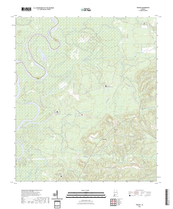
2024 Map of Tensaw
USGS Topo · Published 2024About this map
The Alabama River carves the western boundary of this landscape, creating a complex network of wetlands and oxbows including Silver Lake and Southfield Lake. Central to the area's local history is the site of Fort Mims and the nearby Fort Mims Burial Ground, marking a significant location for early nineteenth-century research. The small settlement of Tensaw serves as a focal point for a rural community defined by scattered family-named roads like Atkinson Mill Rd and Danny Hall Rd. Genealogy is well-represented through several local burial sites, including the Montgomery Hill Cem and Mount Nebo Baptists Church Cem. The terrain south of Tensaw transitions into the dissected uplands around Majors Creek and Slaughter Branch, reflecting the traditional logging and agrarian patterns of Baldwin County.
Find a feature on this map
42 named features on this map. Tap any name to fly to it.
Don’t see what you’re looking for? This feature index may not catch every label — zoom into the map to look around manually.
Map Details
Editions of this 2024 Tensaw Map
This is the sole edition of this map. No revisions or reprints were ever made.
Other maps of this area

1942 · Perdido
USGS Topo · 1:62,500

1943 · Choctaw Bluff
USGS Topo · 1:62,500

1943 · Tensaw
USGS Topo · 1:62,500

1944 · Tensaw
USGS Topo · 1:62,500

1944 · Perdido
USGS Topo · 1:62,500

1946 · Choctaw Bluff
USGS Topo · 1:62,500

1953 · Andalusia
USGS Topo · 1:250,000

1957 · Andalusia
USGS Topo · 1:250,000

1972 · Chrysler
USGS Topo · 1:24,000
1983 · Vaughn
USGS Topo · 1:24,000