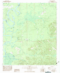
1983 Map of Tensaw
USGS Topo · Published 1983About this map
The Alabama River winds through this landscape on the border of Clarke and Baldwin Counties, defining a region where river transport and local history intersect. Along its banks, numerous landings such as Silver Landing and Boathouse Landing point to the enduring importance of the waterway for commerce and travel. The terrain transitions from the low-lying wetlands of Southfield Lake and Mimms Lake to the more elevated ground at Montgomery Hill, where several community centers are established. This 1983 edition highlights a network of country churches, including Antioch Ch and St Matthews Ch, alongside significant historical markers. Most notably, the site of Fort Mimms (Historical) and its associated Fort Mimms Lookout Tower anchor the area's heritage, reflecting a deep-seated connection to the early frontier and the territorial conflicts that shaped southern Alabama.
Find a feature on this map
39 named features on this map. Tap any name to fly to it.
Don’t see what you’re looking for? This feature index may not catch every label — zoom into the map to look around manually.
Map Details
Editions of this 1983 Tensaw Map
This is the sole edition of this map. No revisions or reprints were ever made.
Other maps of this area

1942 · Perdido
USGS Topo · 1:62,500

1943 · Choctaw Bluff
USGS Topo · 1:62,500

1943 · Tensaw
USGS Topo · 1:62,500

1944 · Tensaw
USGS Topo · 1:62,500

1944 · Perdido
USGS Topo · 1:62,500

1946 · Choctaw Bluff
USGS Topo · 1:62,500

1953 · Andalusia
USGS Topo · 1:250,000

1957 · Andalusia
USGS Topo · 1:250,000

1972 · Chrysler
USGS Topo · 1:24,000
1983 · Vaughn
USGS Topo · 1:24,000