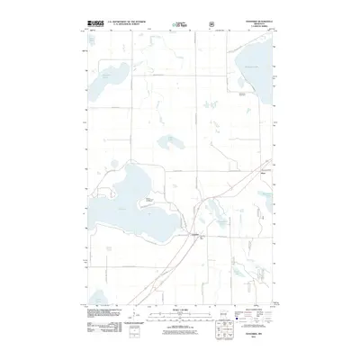
2011 Map of Tenstrike
USGS Topo · Published 2011About this map
Tenstrike and Hines anchor this Beltrami County landscape, where the settlement pattern is deeply tied to the abundant glacial lakes and the historical corridor of Old MN Hwy 71. The presence of both the Tenstrike Post Office and Hines Post Office indicates these small communities remained vital service points for the surrounding rural area into the early 21st century. Much of the local economy and activity appears centered around the water, with Moen's Campground and Resort situated on the northern shore of Gull Lake. The geography is defined by a dense network of water bodies, including Blackduck Lake in the northeast and Medicine Lake in the northwest, connected by O'Brien Creek. Significant local landholdings like the Rutherford Stock Farm and recreational routes such as the Blue Ox Trl reflect the dual agricultural and leisure character of the region.
Find a feature on this map
43 named features on this map. Tap any name to fly to it.
Don’t see what you’re looking for? This feature index may not catch every label — zoom into the map to look around manually.
Map Details
Editions of this 2011 Tenstrike Map
This is the sole edition of this map. No revisions or reprints were ever made.
Other maps of this area

1919 · Quiring
USGS Topo · 1:62,500

1920 · Buena Vista
USGS Topo · 1:62,500

1954 · Bemidji
USGS Topo · 1:250,000

1957 · Bemidji
USGS Topo · 1:250,000

1958 · Bemidji
USGS Topo · 1:250,000
1972 · Blackduck
USGS Topo · 1:24,000

1972 · Turtle River Lake
USGS Topo · 1:24,000
1972 · Pimushe Lake
USGS Topo · 1:24,000

1972 · White Fish Lake
USGS Topo · 1:24,000
1972 · O'Brien Lookout Tower
USGS Topo · 1:24,000