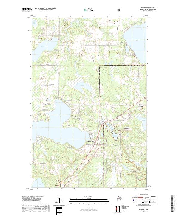
2022 Map of Tenstrike
USGS Topo · Published 2022About this map
The small settlements of Tenstrike and Hines anchor this landscape in northern Beltrami County, situated amidst the dense wetlands and lakes of the Chippewa National Forest. The area is defined by its complex hydrology, dominated by the expansive Gull Lake and Blackduck Lake, which are connected by a network of smaller basins like Medicine Lake and Loon Lake. The presence of the Range Line Canal suggests local efforts to manage this water-rich environment, likely to support the timber industry or local agriculture.
Find a feature on this map
68 named features on this map. Tap any name to fly to it.
Don’t see what you’re looking for? This feature index may not catch every label — zoom into the map to look around manually.
Map Details
Editions of this 2022 Tenstrike Map
This is the sole edition of this map. No revisions or reprints were ever made.
Other maps of this area
1919 · Quiring
USGS Topo · 1:62,500
1920 · Buena Vista
USGS Topo · 1:62,500

1954 · Bemidji
USGS Topo · 1:250,000

1957 · Bemidji
USGS Topo · 1:250,000

1958 · Bemidji
USGS Topo · 1:250,000
1972 · Blackduck
USGS Topo · 1:24,000
1972 · Turtle River Lake
USGS Topo · 1:24,000
1972 · Pimushe Lake
USGS Topo · 1:24,000
1972 · White Fish Lake
USGS Topo · 1:24,000
1972 · O'Brien Lookout Tower
USGS Topo · 1:24,000