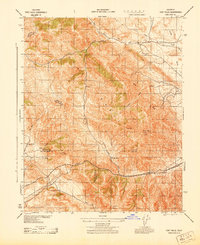
1943 Map of Tent Hills
USGS Topo · Published 1943About this map
The Diablo Range dominates this 1943 survey, where the borders of Monterey, Kings, San Luis Obispo, and Kern Counties converge in a landscape of sharp ridges and winding canyons. This wartime edition, compiled by Fairchild Aerial Surveys for the Army Corps of Engineers, focuses on the high-elevation terrain of the Tent Hills and the transition into the McClure Valley. The map reveals a remote pastoral economy through family-named landmarks and homesteads, including Fahey Ranch and the Iron Spring Ranch. Significant transit corridors like Polonio Pass provide passage through the peaks, while seasonal drainages such as Cottonwood Creek and Avenal Creek define the watershed. The inclusion of triangulation stations like USC & GS Avenal and USC & GS Polonio reflects the meticulous geodetic control required for this early aerial photogrammetric study.
Find a feature on this map
34 named features on this map. Tap any name to fly to it.
Don’t see what you’re looking for? This feature index may not catch every label — zoom into the map to look around manually.
Map Details
Editions of this 1943 Tent Hills Map
This is the sole edition of this map. No revisions or reprints were ever made.
Other maps of this area

1914 · Cholame
USGS Topo · 1:125,000

1915 · Cholame
USGS Topo · 1:125,000

1917 · Cholame
USGS Topo · 1:125,000

1930 · Kettleman Plain
USGS Topo · 1:31,680

1933 · Kettleman Plain
USGS Topo · 1:31,680

1934 · The Dark Hole
USGS Topo · 1:31,680

1934 · Reef Ridge
USGS Topo · 1:31,680
1937 · Reef Ridge
USGS Topo · 1:31,680
1937 · The Dark Hole
USGS Topo · 1:31,680

1942 · Tent Hills
USGS Topo · 1:24,000