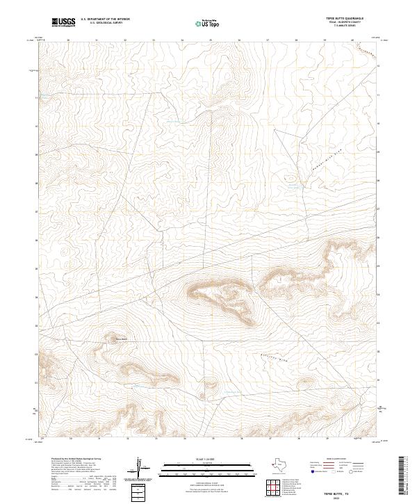
2022 Map of Tepee Butte
USGS Topo · Published 2022About this map
Tepee Butte rises as a prominent landmark within this arid Hudspeth County landscape, which is defined by a sparse but essential network of water collection points. The map details an environment where land management revolves around intermittent drainages such as Number Nine Draw and Antelope Draw. Named water features like Santiago Tank, Charco Tank, and Ventura Tank indicate the vital infrastructure required for cattle ranching and survival in the Trans-Pecos region of West Texas. The scarcity of permanent settlements on this 2022 survey underscores the isolation of the high desert terrain, while the specific naming of points like Number Nine Tank and New Tank provides critical reference points for local history and land usage.
Find a feature on this map
8 named features on this map. Tap any name to fly to it.
Don’t see what you’re looking for? This feature index may not catch every label — zoom into the map to look around manually.
Map Details
Editions of this 2022 Tepee Butte Map
This is the sole edition of this map. No revisions or reprints were ever made.
Other maps of this area

1903 · Cerro Alto
USGS Topo · 1:125,000

1941 · Heuco Mountains
USGS Topo · 1:62,500

1942 · Borrego
USGS Topo · 1:62,500

1943 · Tepee Butte
USGS Topo · 1:62,500

1943 · San Antonio Mtn
USGS Topo · 1:62,500

1943 · Heuco Mountains
USGS Topo · 1:62,500

1954 · Van Horn
USGS Topo · 1:250,000

1958 · Van Horn
USGS Topo · 1:250,000
1977 · Whiterock Hills
USGS Topo · 1:24,000
1978 · Granite Mountain
USGS Topo · 1:24,000