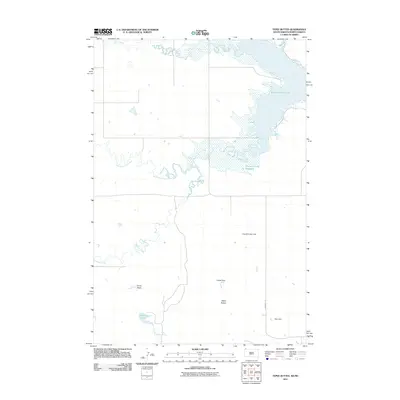
2011 Map of Tepee Buttes
USGS Topo · Published 2011About this map
Tepee Buttes and Corey Butte dominate this landscape in Harding County, marking a terrain defined by significant water management and natural drainage. The northern reaches of the quadrangle are characterized by the expansive waters of Bowman-Haley Lake and the Bowman-Haley Reservoir, which collect the flow from Alkali Creek and the North Fork Grand River. This high-plains geography reveals a series of localized water features, including the uniquely named Nygaard Leaky Dam, Tepee Dam, and Barn Dam, suggesting a history of cattle ranching and water conservation efforts in this arid environment. The presence of Tepee Springs and the small Beermug Lake further emphasize the importance of water sources in this stretch of South Dakota. Crooked Creek meanders through the central portion, illustrating the natural erosive forces that have shaped the buttes and valleys.
Find a feature on this map
14 named features on this map. Tap any name to fly to it.
Don’t see what you’re looking for? This feature index may not catch every label — zoom into the map to look around manually.
Map Details
Editions of this 2011 Tepee Buttes Map
This is the sole edition of this map. No revisions or reprints were ever made.
Other maps of this area

1935 · Reva
USGS Topo · 1:125,000

1953 · Dickinson
USGS Topo · 1:250,000

1954 · Lemmon
USGS Topo · 1:250,000

1957 · Dickinson
USGS Topo · 1:250,000

1957 · Lemmon
USGS Topo · 1:250,000

1968 · Bowman SW
USGS Topo · 1:24,000

1968 · Eagles Nest Butte
USGS Topo · 1:24,000

1968 · Ralph SW
USGS Topo · 1:24,000

1968 · Bowman-Haley Dam
USGS Topo · 1:24,000

1968 · Ludlow
USGS Topo · 1:24,000