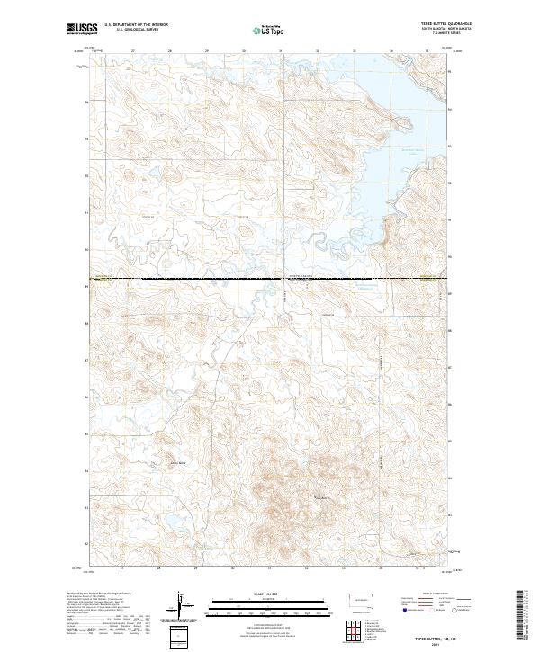
2021 Map of Tepee Buttes
USGS Topo · Published 2021About this map
Tepee Buttes and the surrounding high plains define this landscape along the border of the Dakotas. The map illustrates a remote ranching and grazing region where water sources like Tepee Springs and drainage systems including Alkali Creek and Crooked Cr dictated the early organization of the land. In the north, the waters of the Bowman-Haley Reservoir and Bowman-Haley Lake dominate the terrain, reflecting the engineering and water management vital to this arid environment. The transition from North Dakota to South Dakota is marked by Stateline Rd, which cuts across a complex series of buttes and draws, including Corey Butte. This survey provides a clear view of the sparse rural infrastructure, showing how Lanesboro Rd and Rock Rd navigate the undulating elevations and river valleys like the N Fork Grand River.
Find a feature on this map
23 named features on this map. Tap any name to fly to it.
Don’t see what you’re looking for? This feature index may not catch every label — zoom into the map to look around manually.
Map Details
Editions of this 2021 Tepee Buttes Map
This is the sole edition of this map. No revisions or reprints were ever made.
Other maps of this area

1935 · Reva
USGS Topo · 1:125,000

1953 · Dickinson
USGS Topo · 1:250,000

1954 · Lemmon
USGS Topo · 1:250,000

1957 · Dickinson
USGS Topo · 1:250,000

1957 · Lemmon
USGS Topo · 1:250,000

1968 · Bowman SW
USGS Topo · 1:24,000

1968 · Eagles Nest Butte
USGS Topo · 1:24,000

1968 · Ralph SW
USGS Topo · 1:24,000

1968 · Bowman-Haley Dam
USGS Topo · 1:24,000

1968 · Ludlow
USGS Topo · 1:24,000