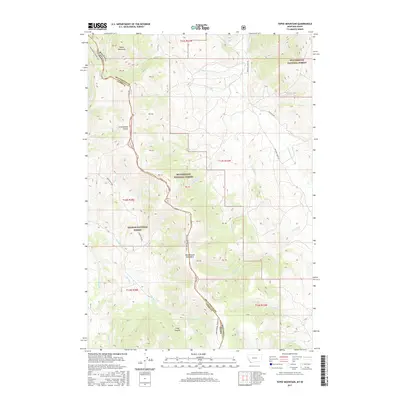
2017 Map of Tepee Mountain
USGS Topo · Published 2017About this map
Tepee Mountain and the high ridges of the Beaverhead Mountains define this high-altitude borderland between Montana and Idaho. The Continental Divide runs north to south, serving as both a topographic backbone and the administrative boundary between Beaverhead National Forest and Salmon National Forest. This 2017 survey documents the modern layout of the Continental Divide NST, which winds through the mountain passes alongside early cattle-ranching routes. Drainage systems like Medicine Lodge Cr and Hildreth Cr flow toward the valleys below, following paths established long before the formal surveys of the Medicine Lodge Rd. Local landmarks such as Meadow Divide and Long Canyon illustrate the complex geography that has historically separated the Lemhi and Beaverhead basins, preserving a remote landscape of forest and creek beds.
Find a feature on this map
34 named features on this map. Tap any name to fly to it.
Don’t see what you’re looking for? This feature index may not catch every label — zoom into the map to look around manually.
Map Details
Editions of this 2017 Tepee Mountain Map
This is the sole edition of this map. No revisions or reprints were ever made.
Other maps of this area
1955 · Dubois
USGS Topo · 1:250,000
1956 · Morrison Lake
USGS Topo · 1:62,500
1958 · Dubois
USGS Topo · 1:250,000
1965 · Deadman Pass
USGS Topo · 1:24,000
1965 · Graphite Mountain
USGS Topo · 1:24,000
1965 · Deer Canyon
USGS Topo · 1:24,000
1965 · Medicine Lodge Peak
USGS Topo · 1:24,000
1965 · Island Butte
USGS Topo · 1:24,000
1980 · Leadore
USGS Topo · 1:100,000
1987 · Morrison Lake
USGS Topo · 1:24,000