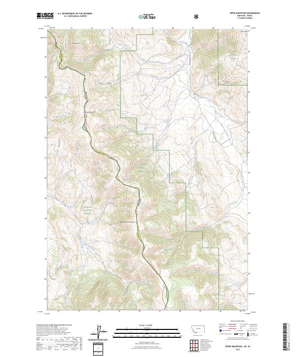
2024 Map of Tepee Mountain
USGS Topo · Published 2024About this map
The Continental Divide forms a high-altitude spine across this landscape, marking the rugged boundary between Beaverhead National Forest in Montana and the Salmon National Forest in Idaho. This high-country drainage system is defined by the Beaverhead Mountains, where numerous seasonal and perennial waters like Reservoir Creek, Hildreth Creek, and Meadow Creek originate. The presence of the Continental Divide National Scenic Trl tracing the ridge lines highlights the area's role as a critical corridor for backcountry travel and conservation.
Find a feature on this map
50 named features on this map. Tap any name to fly to it.
Don’t see what you’re looking for? This feature index may not catch every label — zoom into the map to look around manually.
Map Details
Editions of this 2024 Tepee Mountain Map
This is the sole edition of this map. No revisions or reprints were ever made.
Other maps of this area

1955 · Dubois
USGS Topo · 1:250,000

1956 · Morrison Lake
USGS Topo · 1:62,500

1958 · Dubois
USGS Topo · 1:250,000

1965 · Deadman Pass
USGS Topo · 1:24,000

1965 · Graphite Mountain
USGS Topo · 1:24,000

1965 · Deer Canyon
USGS Topo · 1:24,000
1965 · Medicine Lodge Peak
USGS Topo · 1:24,000

1965 · Island Butte
USGS Topo · 1:24,000

1980 · Leadore
USGS Topo · 1:100,000
1987 · Morrison Lake
USGS Topo · 1:24,000