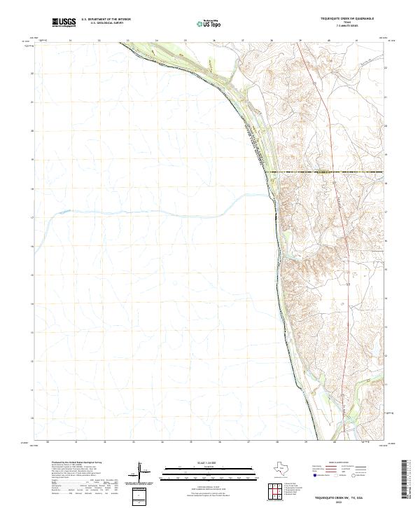
2022 Map of Tequesquite Creek SW
USGS Topo · Published 2022About this map
The Rio Grande defines the international boundary between the United States and Mexico in this arid reach of the Southwest. Several drainage systems converge toward the river from the Texas side, including Tequesquite Cr, Cow Cr, and Las Moras Cr, creating a landscape of dissected terrain along the border. The map also records the administrative division between Kinney and Maverick counties. This contemporary survey details the transportation infrastructure serving the remote borderland, dominated by Del Rio Blvd and Ranch Rd 1908. For those studying the geography of the Rio Grande basin, this map provides a precise view of the hydrology and property boundaries as they exist in the early twenty-first century.
Find a feature on this map
8 named features on this map. Tap any name to fly to it.
Don’t see what you’re looking for? This feature index may not catch every label — zoom into the map to look around manually.
Map Details
Editions of this 2022 Tequesquite Creek SW Map
This is the sole edition of this map. No revisions or reprints were ever made.
Other maps of this area

1940 · Quemado
USGS Topo · 1:62,500

1941 · Tequesquite Creek
USGS Topo · 1:62,500

1944 · Sycamore Ranch
USGS Topo · 1:62,500

1944 · Tequesquite Creek
USGS Topo · 1:62,500

1958 · Eagle Pass
USGS Topo · 1:250,000

1958 · Del Rio
USGS Topo · 1:250,000

1964 · Del Rio
USGS Topo · 1:250,000

1965 · Eagle Pass
USGS Topo · 1:250,000
1978 · Tequesquite Creek NE
USGS Topo · 1:24,000
1978 · Tequesquite Spring
USGS Topo · 1:24,000