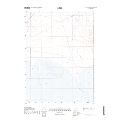
2023 Map of Terrace Mountain West
USGS Topo · Published 2023About this map
Old Railroad Grade Rd cuts through the northern reaches of this Great Basin landscape, tracing the path of former industrial infrastructure through Box Elder County. The terrain is defined by the ephemeral flows of Muddy Creek and Rosebud Creek, which navigate the basin's floor alongside the distinct alluvial features of Sand Wash. This survey reflects a sparsely populated area where the remnants of rail history intersect with the natural hydrography of the high desert. The map provides a precise view of the topography surrounding these drainages, illustrating the drainage patterns that characterize the region west of Terrace Mountain. It is a vital document for understanding the intersection of historical transit routes and the arid environment of western Utah.
Find a feature on this map
4 named features on this map. Tap any name to fly to it.
Don’t see what you’re looking for? This feature index may not catch every label — zoom into the map to look around manually.
Map Details
Editions of this 2023 Terrace Mountain West Map
This is the sole edition of this map. No revisions or reprints were ever made.
Other maps of this area

1954 · Brigham City
USGS Topo · 1:250,000

1958 · Brigham City
USGS Topo · 1:250,000

1962 · Brigham City
USGS Topo · 1:250,000

1971 · Prohibition Spring
USGS Topo · 1:24,000

1971 · Emigrant Pass
USGS Topo · 1:24,000

1971 · Red Dome
USGS Topo · 1:24,000

1983 · Jackson
USGS Topo · 1:24,000

1983 · Lemay
USGS Topo · 1:24,000

1983 · Bovine SE
USGS Topo · 1:24,000

1983 · Terrace Mountain West
USGS Topo · 1:24,000