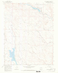
1967 Map of Terrace Reservoir
USGS Topo · Published 1970About this map
La Jara Reservoir and Terrace Reservoir anchor this high-elevation landscape within the Rio Grande National Forest. During the mid-1960s, this area of Conejos County functioned as active rangeland, characterized by the Stock Driveway and a network of seasonal outposts such as Shawcroft Cow Camp and Baxter and Martin Cow Camp. The drainage patterns are defined by the Alamosa River in the north and the complex canyon systems of Hot Creek and Piedrosa Creek in the south.
Find a feature on this map
25 named features on this map. Tap any name to fly to it.
Don’t see what you’re looking for? This feature index may not catch every label — zoom into the map to look around manually.
Map Details
Editions of this 1967 Terrace Reservoir Map
4 editions found
Other maps of this area

1922 · Conejos
USGS Topo · 1:125,000

1945 · Durango
USGS Topo · 1:250,000

1953 · Durango
USGS Topo · 1:250,000

1954 · Durango
USGS Topo · 1:250,000

1961 · Durango
USGS Topo · 1:250,000

1963 · Durango
USGS Topo · 1:250,000

1966 · Durango
USGS Topo · 1:250,000
1967 · Spectacle Lake
USGS Topo · 1:24,000
1967 · La Jara Canyon
USGS Topo · 1:24,000
1967 · Jasper
USGS Topo · 1:24,000