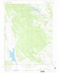
1967 Map of Terrace Reservoir
USGS Topo · Published 1981About this map
Terrace Reservoir and La Jara Reservoir dominate this high-elevation landscape within the Rio Grande National Forest, where controlled inundation zones and seasonal drainages define the hydrology of the upper Alamosa River basin. The area’s ranching heritage is evidenced by the presence of Shawcroft Cow Camp and Baxter and Martin Cow Camp, alongside a designated Stock Driveway that cuts across the northern terrain near Jacobs Hill. This network of Jeep Trails and water management features, including a Gaging Sta and a spillway at the northern reservoir, reflects the mid-century integration of public forest land for both water storage and livestock movement. Numerous creeks, such as Hot Creek, Piedrosa Creek, and Torsid Creek, carve through the complex topography of Bald Ridge and La Jara Meadows.
Find a feature on this map
26 named features on this map. Tap any name to fly to it.
Don’t see what you’re looking for? This feature index may not catch every label — zoom into the map to look around manually.
Map Details
Editions of this 1967 Terrace Reservoir Map
4 editions found
Other maps of this area

1922 · Conejos
USGS Topo · 1:125,000

1945 · Durango
USGS Topo · 1:250,000

1953 · Durango
USGS Topo · 1:250,000

1954 · Durango
USGS Topo · 1:250,000

1961 · Durango
USGS Topo · 1:250,000

1963 · Durango
USGS Topo · 1:250,000

1966 · Durango
USGS Topo · 1:250,000
1967 · Spectacle Lake
USGS Topo · 1:24,000
1967 · La Jara Canyon
USGS Topo · 1:24,000
1967 · Jasper
USGS Topo · 1:24,000